
Digital Twin Modelling & 3D Scanning
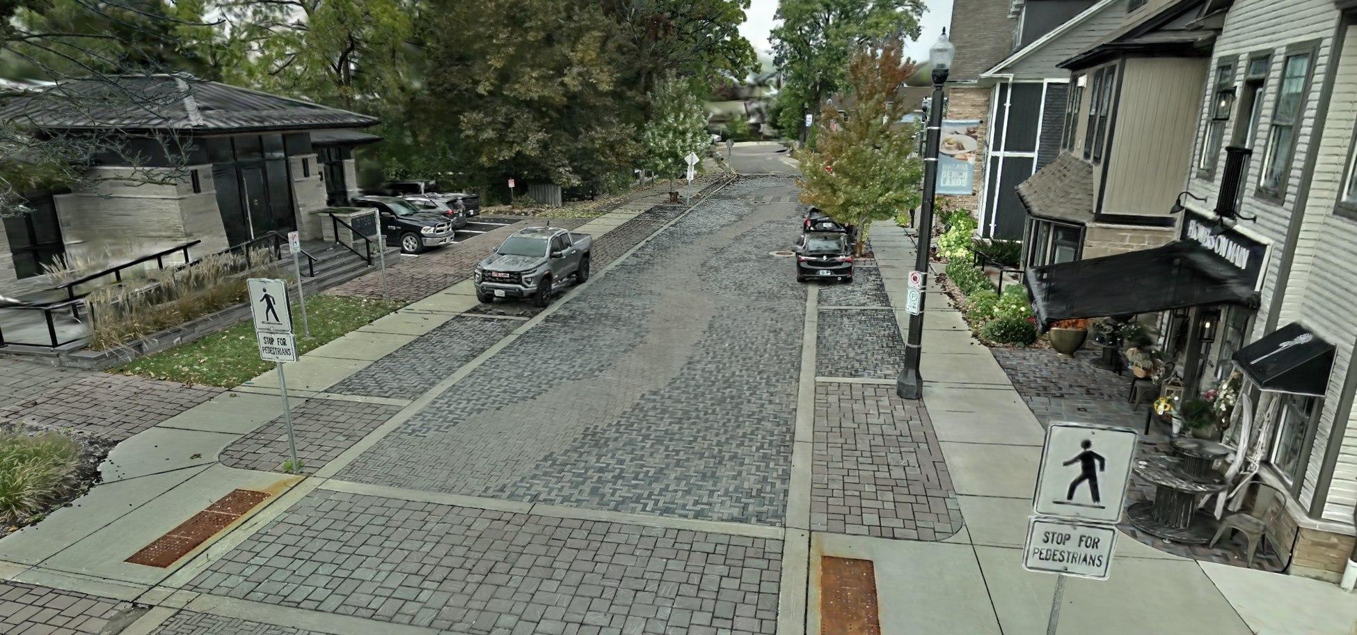
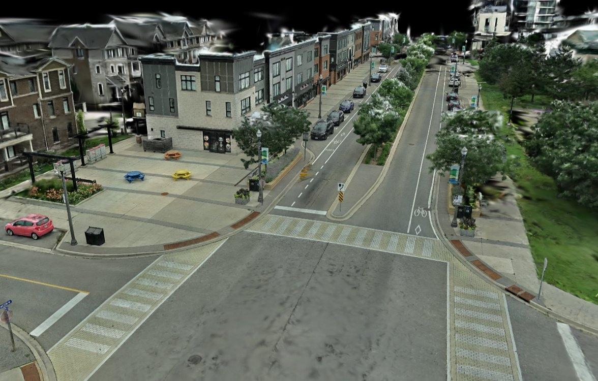
We scan streets, sites, and buildings, indoors and outdoors, with high-accuracy 3D LiDAR and deliver the result as a digital twin: a realistic, true-scale 3D model of existing conditions that your team can walk through and measure in a web browser.
Serving municipalities across Ontario from St. Catharines.
What we deliver
- A realistic, true-scale 3D model you can walk through and measure in a browser
- LiDAR point cloud tied to project control
- Base plans drawn from the model, in engineering or architectural style
- Contours, levels, and sections taken from the same model
- Time-stamped 360° imagery along the scan path, a dated street view of your corridor
- Floor plans, building details, and existing-conditions drawings from indoor scans
- Pre-construction condition records and as-built scans
Outdoor scanning
- Streets, intersections, and road corridors, measured without a crew standing in the road
- Curbs, sidewalks, pavement markings, signs, poles, and building faces captured in one pass
- Sites, yards, parks, and parking areas
- Above-ground structures and every visible asset in the corridor
- Drone capture for corridors and hard-to-access sites
Indoor scanning
- Municipal buildings and facilities, scanned room by room
- Floor plans and interior layouts drawn from the scan
- Building details and existing-conditions drawings for renovation and design
- Indoor and outdoor scans joined into one model of a building and its site
How a digital twin is built
A digital twin comes from four things working together. LiDAR measures the shape and size of every surface, which gives the scene its true scale. Positioning software tracks the scanner as it is walked through the site, so every laser sweep lands in the right place. 360° cameras photograph everything at the same time, adding colour and texture so the scene looks like the real place. Control points shot with a GNSS rover tie the scene to project coordinates.
Each scan starts and finishes on the same point to close the loop, and is checked against survey control.
What a scan cannot see
A scanner records only what is in its line of sight, so it does not capture what sits under a parked car or inside a catch basin. Dark or wet surfaces return weaker data, and accuracy depends on survey control.
Buried utilities are outside what a scan can record. For those we work with locating and subsurface utility engineering partners.
From scan to deliverable
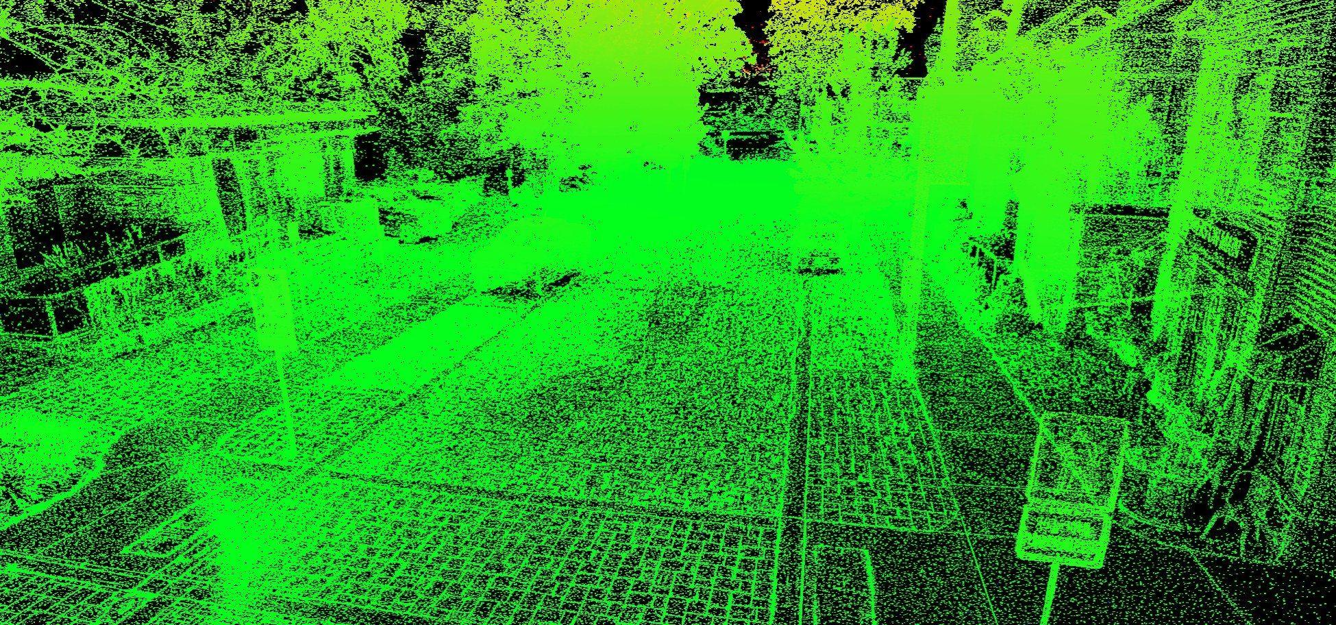
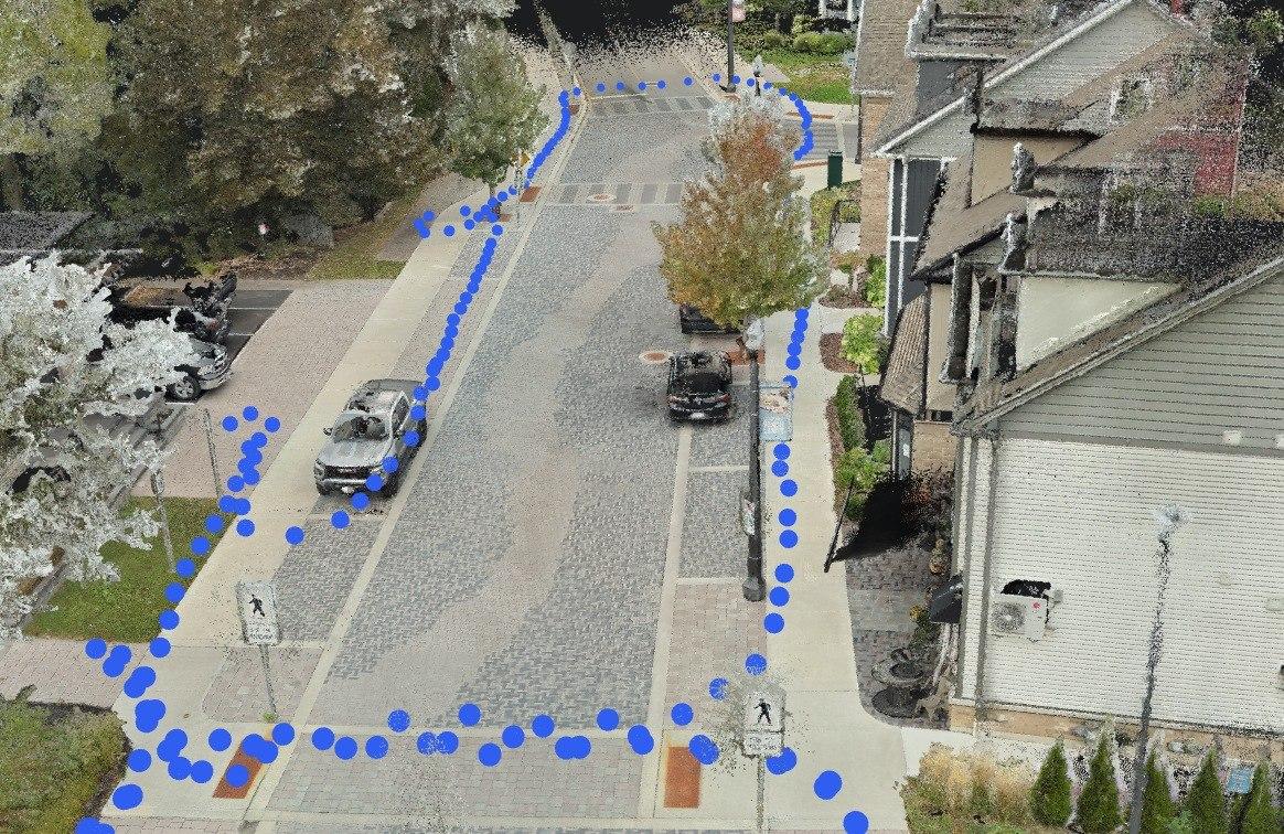
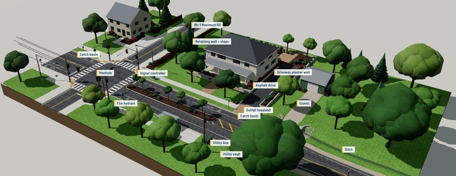
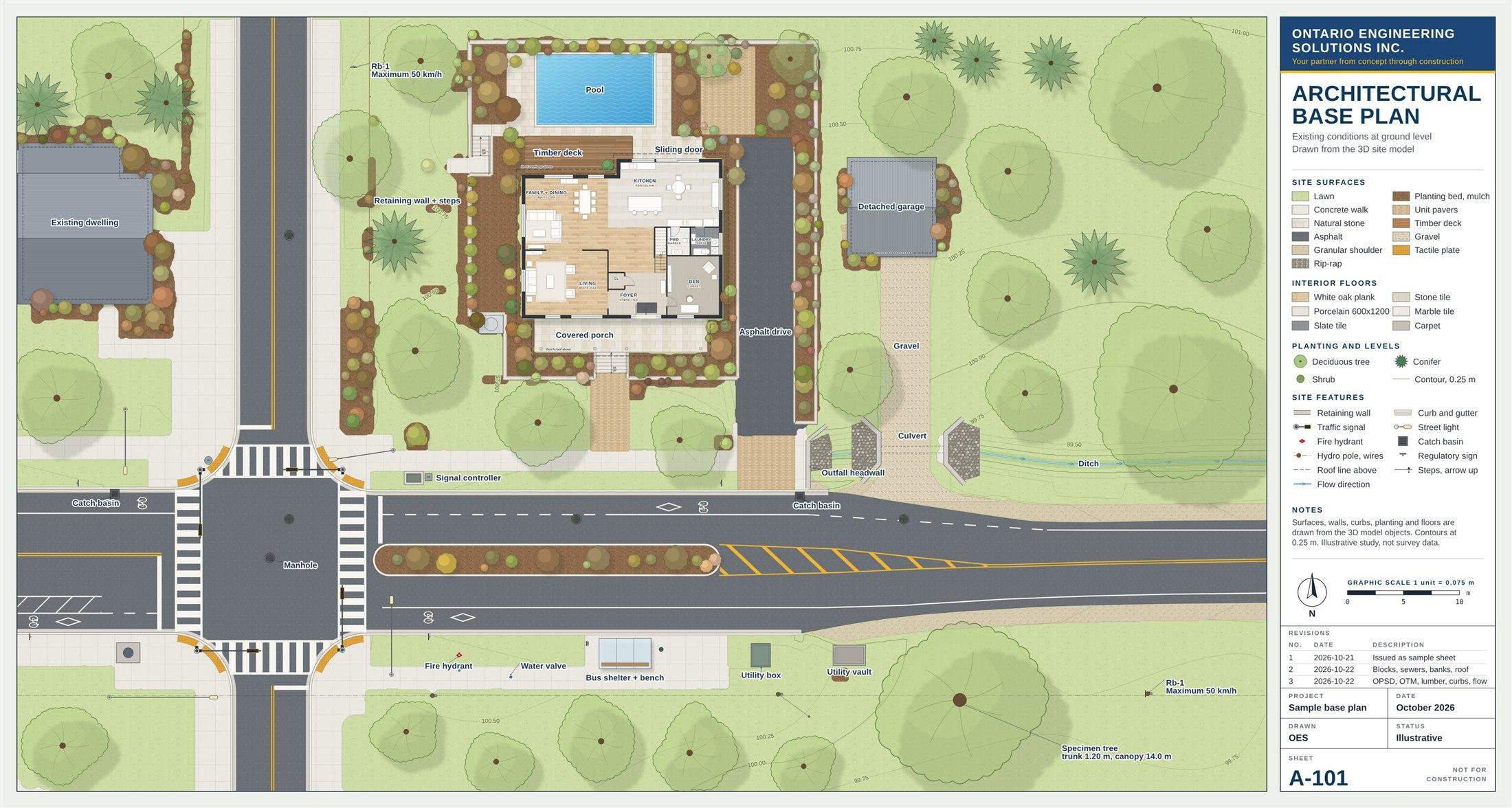
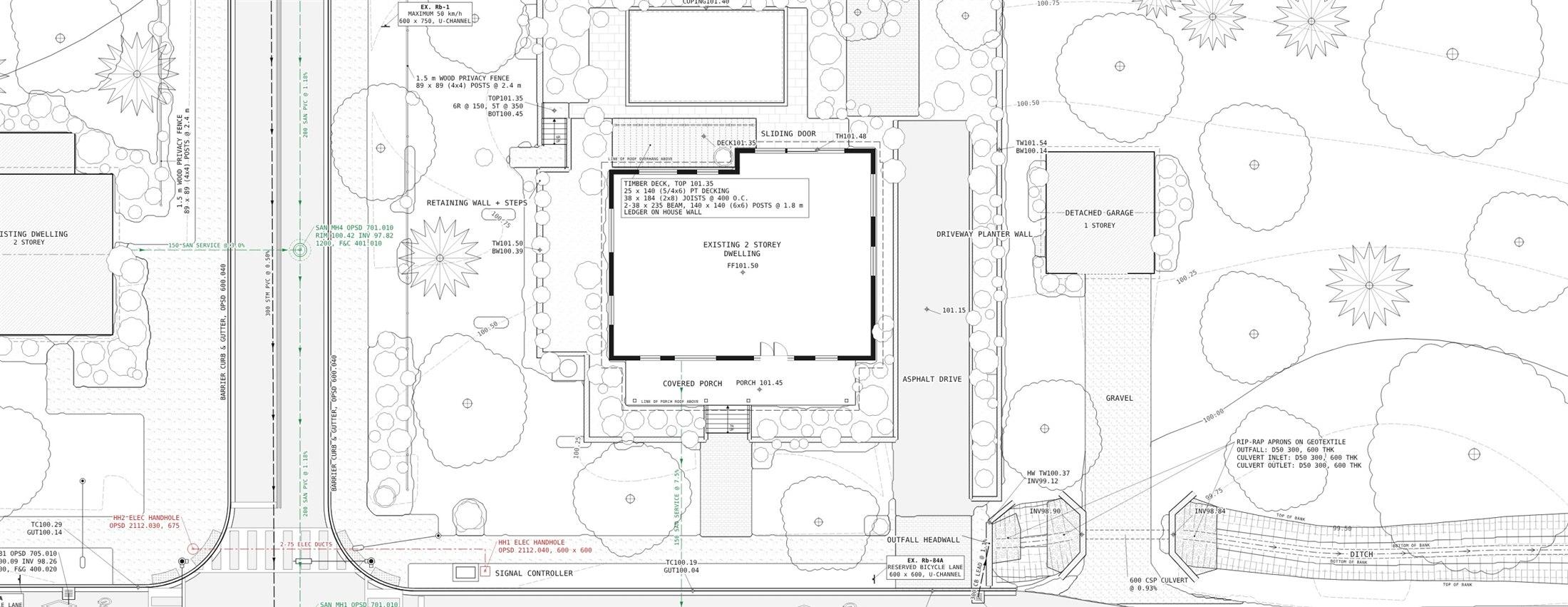
Sample deliverable
Common questions
- What is the difference between a 3D scan and a digital twin?
- The scan is the capture: measured points and imagery collected on site with LiDAR. The digital twin is what you receive: a navigable 3D model of the site as it exists, which opens in a browser and can be used alongside your drawings.
- How accurate is a scan?
- Less than 5 cm horizontal and vertical accuracy, with every scan tied to survey control.
- Do we need special software to view the model?
- No. The model is delivered as a link that opens in a standard web browser, so staff, councillors, and contractors can all look at the same site.
- Can you scan inside buildings?
- Yes. We scan indoor and outdoor spaces, and can join them into one model of a building and its site. Floor plans and building details are drawn from the capture.
More in Topographic Survey & Data Collection
Request a quote for Digital Twin Modelling & 3D Scanning.
Tell us what you need, or share your availability for a call. A licensed Professional Engineer will respond within one business day.