
Topographic Survey
We complete engineering topographic surveys by RTK GNSS rover, supplemented with LiDAR scanning, and offer rapid turnaround when your design schedule is tight. Base plans are delivered in your CAD standard and on your datums, and every topographic survey includes a 3D scan of the site at no additional cost.
Serving municipalities across Ontario from St. Catharines.
What we deliver
- Rapid turnaround topographic surveys
- Topographic base plans in any Ontario CAD standard
- Surveys by RTK GNSS rover, supplemented with LiDAR scanning, on municipal and regional datums
- SUE Level A or B investigations coordinated and included in your base plans
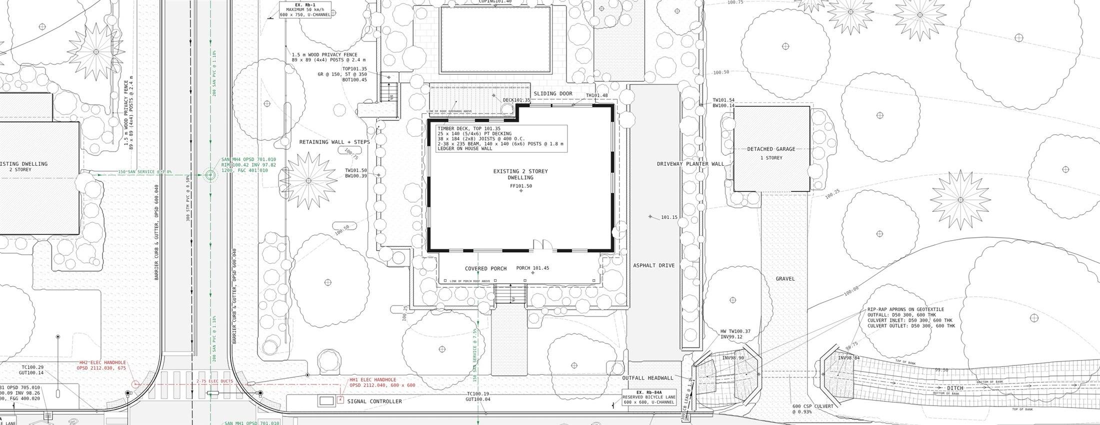
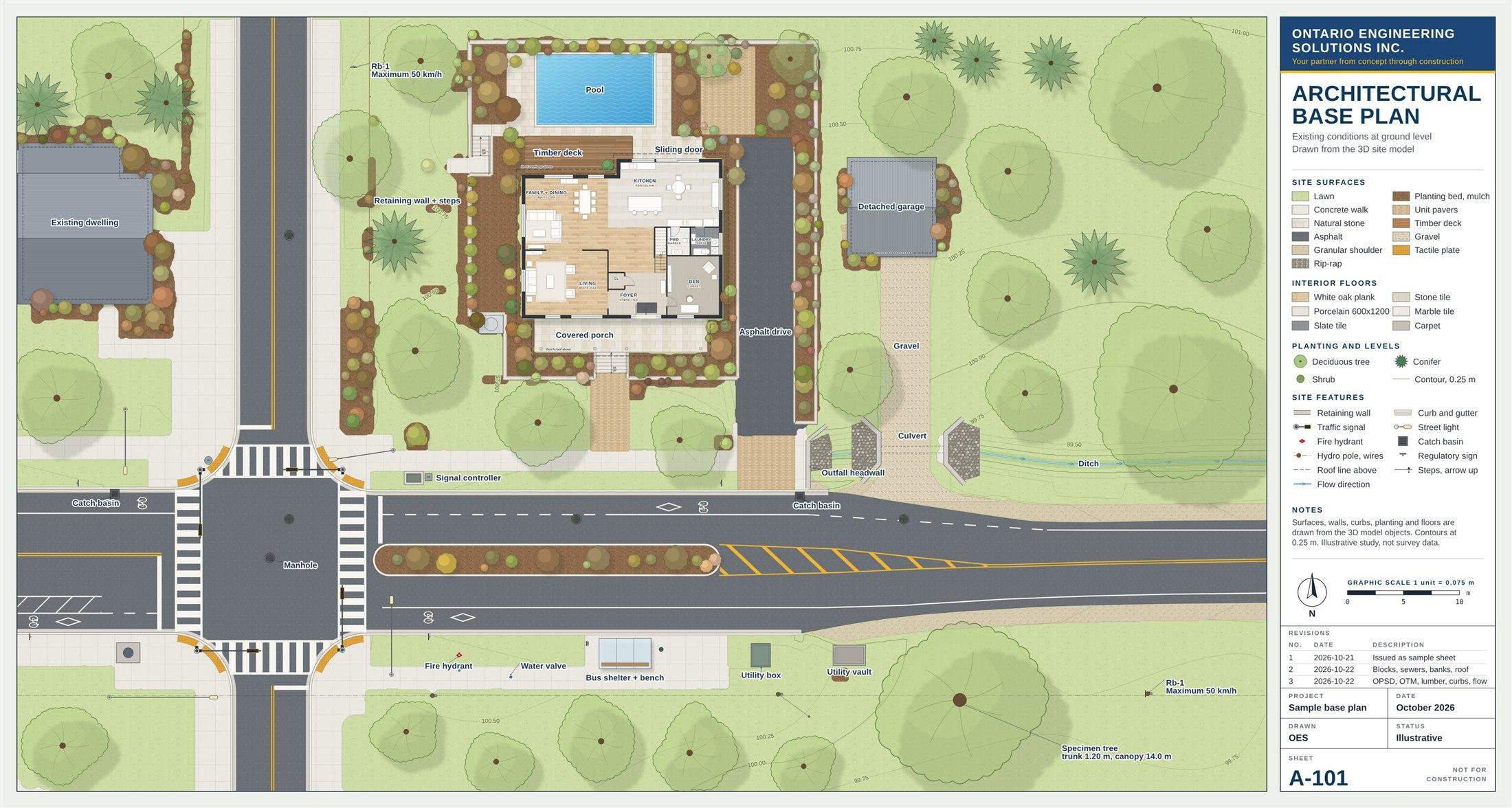
- Road corridors, intersections, culverts, ditches, and drainage features
- Drone surveys for corridors and hard-to-access sites
- Base plans in engineering or architectural style, with profiles ready for design
- A 3D scan of the site with every survey, at no additional cost
For legal surveys we maintain partnerships with local Ontario Land Surveyors. We can also coordinate subsurface utility engineering (SUE) at Level A or Level B and include the results in your base plans.
When a topographic survey is needed
- Before detailed design of road, drainage, watermain, sewer, or active transportation projects
- To confirm culvert inverts, ditch grades, and drainage paths for a hydraulic assessment
- Where record drawings are missing, out of date, or disagree with the field
- To record existing conditions before construction starts
What we capture
- Road surface, edge of pavement, curb, shoulder, and centreline
- Culverts, maintenance holes, catch basins, and ditch inlets with inverts
- Ditches, embankments, and the breaklines that control drainage
- Guide rail, signs, driveways, entrances, and surface utility features
Sample base plans
Common questions
- Do you provide legal or boundary surveys?
- No. Legal and boundary surveys in Ontario are completed by an Ontario Land Surveyor. Our topographic surveys are for engineering design. Where a project needs property boundaries, we bring in an Ontario Land Surveyor partner and deliver the work as one team.
- Can subsurface utility information be included in the base plans?
- Yes. We can coordinate subsurface utility engineering (SUE) at Level A or Level B and include the results in your base plans.
- What CAD standard do you deliver in?
- Any Ontario CAD standard. Tell us which municipal or regional standard the drawings need to follow and we deliver base plans in that format, on your datums.
- Is the 3D scan included in the price?
- Yes. Every topographic survey includes a 3D scan of the site at no additional cost, delivered as a link your team can open in a browser.
Related project
All projects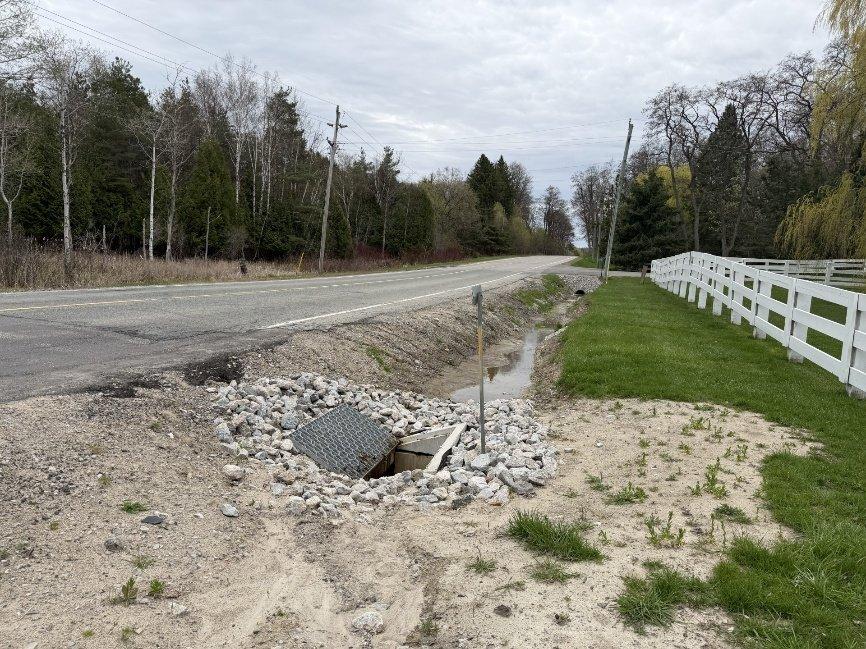
More in Topographic Survey & Data Collection
Request a quote for Topographic Survey.
Tell us what you need, or share your availability for a call. A licensed Professional Engineer will respond within one business day.